The Whanganui River
The Whanganui River is central to the existence of Whanganui Iwi and their health and wellbeing. The River has provided both physical and spiritual sustenance to Whanganui Iwi and its hapū from time immemorial.
The Whanganui River has acted from early times as an artery for Māori inhabiting its forests and fertile river terraces and travelling to and from the central North Island. There are numerous kāinga and pā sites, urupā and other wāhi tapu throughout the length of the River and there remain many active marae on the River today.
Other groups with interests in the parts of the Whanganui River and its tributaries include the iwi of Ngāti Tūwharetoa, Ngāti Maniapoto, Ngāti Rereahu, Ngāti Maru, Ngāti Ruanui, Ngā Rauru Kītahi and Ngāti Apa and certain of their hapū.
The Whanganui River is of significant national importance. It is New Zealand’s longest navigable river, stretching for 290km from the slopes of Mount Tongariro to the Tasman Sea. With its headwaters in the Tongariro National Park and bounded for much of its middle reaches by the Whanganui National Park, the Whanganui River has significant natural, scenic, and recreational values. It is an important habitat for indigenous fish and whio.
The River also plays an important role in power generation with waters diverted by the Tongariro Power Scheme from the River’s headwaters into Lake Taupō and on into the Waikato River contributing to the generation of approximately 5% of New Zealand’s electricity.
The issue of the ownership of the Whanganui River has been a longstanding focus of grievance for Whanganui Iwi. As at 1840 the iwi and hapū of Whanganui possessed and exercised rights and responsibilities in relation to, the Whanganui River in accordance with their tikanga.
Various statutes and actions of the Crown over more than 100 years have dramatically affected the legal ownership and management of the Whanganui River and the ability of Whanganui Iwi to exercise its full rights and responsibilities in relation to the River. The Coal-Mines Act Amendment Act 1903 declared that the beds of all navigable rivers “shall remain and shall be deemed to have always been vested in the Crown” and the Crown has considered the main stem of the Whanganui River from its mouth to Taumarunui at least to be navigable.
Despite this, the iwi and hapū of Whanganui have, over many generations since 1840, maintained the position that they never relinquished their rights and interests in the Whanganui River and have sought to protect and provide for their relationship with the Whanganui River in many ways.
Timeline of changes on the Whanganui River
-
1849
The right of Eel Fishing is reserved for Māori in different streams.

Image: Early painting of Pipiriki Settlement by John Gully.
Alexander Turnbull Library, Wellington, New Zealand
-
1877
Whanganui Iwi objects to Habour board regulations that threaten ancient fishing grounds and subsequently destroy the economic base of Whanganui Iwi.

Image: Alexander Turnbull Library, Wellington, New Zealand
-
1880
Pā tuna (Eel Wiers) are destroyed as Government colonists clear the Whanganui River for free navigation by steamers and gold and coal prospectors.

Image: Alexander Turnbull Library, Wellington, New Zealand
-
1882
Gravel is extracted from the Whanganui River for roads, degrading traditional fishing sites. In 1883 Pā tuna continue to be destroyed to make way for steamers.

Image: Alexander Turnbull Library, Wellington, New Zealand
-
1884
Coal is found at Tangarakau.

Image: Alexander Turnbull Library, Wellington, New Zealand
-
1885
Salmon are released into the upper Whanganui River. Steamer and mail services are also established.

Image: The carved house Wharewhiti at Parikino Marae taken in 1885 by Henry Burton.
1886
1886 -1888 over 501 Iwi members petition the government to stop steamers destroying the pā tuna and utu piharau (lampery weirs)
Image: Alexander Turnbull Library, Wellington, New Zealand
-
1888
1888 - 1891 the Government continues to drain swamps, clear rapids and destroy pā tuna.

Image: Eel Weir at Pungarehu, on the banks of the Whanganui River between 1856-1889.
1895
Whanganui Iwi take claim to the Supreme Court over customary fishing rights. In 1896 the Whanganui River Trust Board (an agency of the Crown) is established, giving control of the River to the colonists.
Image: Alexander Turnbull Library, Wellington, New Zealand
-
1896
Iwi seek compensation from the Crown for the gravel taken from the Awa. In 1903 the Coal Mines Act of 1891 is amended so that beds of the navigable rivers are vested in his Majesty the King.

-
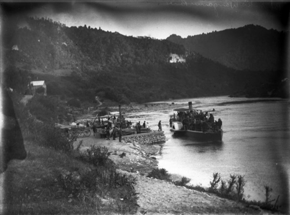
1907
The Aotea Māori Land Court rule Iwi are entitled to compensation for gravel removed from the Awa. In 1913, 196 Whanganui Iwi members petition the Court to halt the taking of riparian land by the Crown under the Scenic Reserves Act.

Image: Group aboard the steamer Ohura, Whanganui River 1905
Alexander Turnbull Library, Wellington, New Zealand
-
1918
The Whanganui River Trust Board seeks legal advice for the removal of gravel from the Awa. In 1919 the Whanganui River Trust Board declares that Whanganui Iwi must not construct new pā tuna.

Image: Alexander Turnbull Library, Wellington, New Zealand
-
1920
Settlers propose a system of hydroelectric dams on the Whanganui River. The Whanganui River Trust Board is granted entitlement under the NZ Statutes to take gravel from the Awa.

Image: Ethnologist Elsdon Best (left) with a hinaki during his visit to the Whanganui River.
Photographed in 1921 by James Ingram McDonald.
Alexander Turnbull Library, Wellington, New Zealand
-
1927
Te Piki Kotuku and other unsuccessfully petition parliament for $300,000 compensation for the loss of native rights on the Whanganui Awa.

Image: Alexander Turnbull Library, Wellington, New Zealand
-
1931-1937
Whanganui iwi fundraise for the legal battle to protect their customary rights. In 1936, Te Rama Whanarere, Te Kiira Peina, Hekenui Whakarake, Titi Tihu and others lodge a petition to challenge the ownership of the Awa.

Image: Horwood, M. Wilson, C. 2008. Te Ara Tapu: Sacred Journeys. Auckland NZ. Random House NZ
-
1937
Titi Tihu and Hikaia Amohia formally object to the introduction of trout by the Acclimatisation Authority.

Image: Rangihikatea Maihi (seated closest to the Awa) and two others overlooking the Whanganui River.
Alexander Turnbull Library, Wellington, New Zealand
-
1939
The Crown appeals against the appellate Court decision to the Supreme Court and seeks to block the Māori Land Court ruling on the title of the Whanganui River bed.

Image: Photograph by Lawrence Aberhart.
1949
Judge Hay rules that the coal Mine Amendment Act of 1903 had given ownership of the bed of the River to the Crown. As a result the areas of the riverbed are deemed part and parcel to the sale of adjacent land blocks.
1950
A Royal Commission of Inquiry is established to determine whether Iwi customarily owned the riverbed. In 1955 the Court of Appeal finds the "the bed of the Whanganui River had been owned under the Maori custom"
Image: Alexander Turnbull Library, Wellington, New Zealand.
-
1959
Hikaia Amohia formally objects to the headwaters of the Whanganui River being diverted. He is ruled out of order. In 1960 the headwaters of the River are diverted into Lake Rotoaira, then on into Lake Taupo and the Waikato catchment for hydroelectric power generation.

-
1962
The Court of Appeal says that the 1903 Act conveyed the riverbed to the Crown. This decision closes all legal avenues for Iwi to pursue ownership of the riverbed. Hikaia Amohia objects again to the diversion and a lack of consultation with Whanganui Iwi. Again he is ruled out of order. In 1969 the Taumarunui Borough Council receive annual compensation as a result of the diversion of the headwaters. Whanganui Iwi received nothing.

-
1977
Whanganui Iwi petition the Queen concerning the rights to the River. In 1978 Prime Minister Holyoake advises the proper place for the petition is the House of Representatives.
In 1981 the Minister of Māori Affairs, Ben Couch recommends Parliament take no action on the petition.

1986
The New Zealand Gazette establishes Water Control Orders over the Whanganui River.
The Whanganui National Park is established but excludes the River due to an Iwi petition.
The Minister of Lands promises Iwi participation in the running of the park, but fails to deliver.

1988

The Whanganui River Māori Trust Board is established to negotiate all outstanding claims relating to the customary rights of Whanganui Iwi.
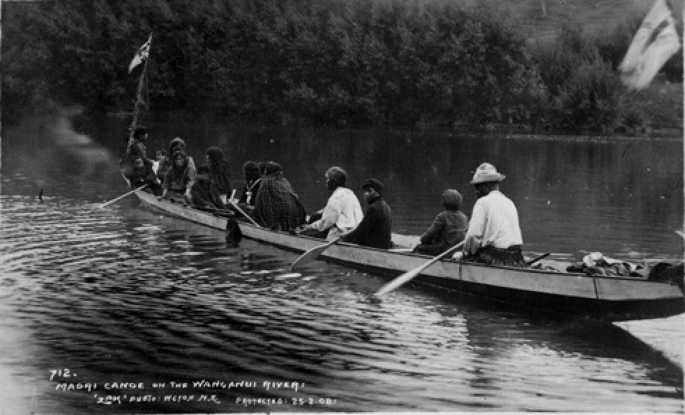
In 1989 Iwi begin Te Tira Hoe Waka, an annual 2 week pilgrimage that revisits the sacred sites and Marae along the Whanganui River.
-
1990
Electricorps application for a minimum flow regime in the River is appealed by Iwi. The planning tribunal lasts 83 days and results in minimum flow provisions for the Whanganui and Whakapapa Rivers

-
1991
Negotiations with the Crown address a framework for ownership of the river. In 1993 the negotiations are suspended and the Crown refuses to sign the proposed framework.

-
1994
A framework for the creation of the three-tupuna rohe runanga is implemented.
The Resource Management Act prompts greater Iwi input into the consent process.

Thomas Downes 1868-1938: The Kawau-tahi taniwha.
A taniwha, depicted as akin to a dragon, appearing from flax bushes and chasing away four surveyors around a theodolite A-076-012
Alexander Turnbull Library
1995
Whanganui Iwi occupy Pākaitore for 80 days, and then commemorate the event each year.
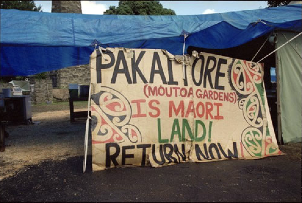
Pākaitore Occupation
-
1999
In June 1999 the Waitangi Tribunal releases the Whanganui River Report and confirms that the Māori text of the Treaty of Waitangi guarantees the rangatatiratanga of Iwi.
In 1999 Te Rūnanga o Te Awa Tupua is officially recognised as the authority responsible for Iwi governance. The then Minister in charge of Treaty Negotiations, Doug Graham assures the split-up of Electricorp NZ will not affect the rights and interests of Iwi.

-
2001
The Crown, Whanganui District Council and Te Atihaunui-a-Pāpārangi vest Pakaitore as a historic reserve.
A joint board consisting of Council, Iwi and Crown representatives is formed to manage the reserve in accordance with the Reserves Act 1977.
Genesis apply to the Regional District Council for a 35 year resource consent to continue to divert the Whanganui headwaters for power generation.

-
2003
On the 6th of March a Terms of negotiation document was signed by the Crown and Whanganui Iwi at Matahiwi Marae.
In October Whanganui Iwi oppose a further 35 year resource consent to continue to divert the Whanganui headwaters in the environment court.

-
2004
March: The Crown introduce Shortfin and Longfin eels into the quota Management system.
April-May: The Foreshore and Seabed march from Te Rerenga Wairua to Parliament consists of 30,000 people from Aotearoa.
Te Awa Tupua negotiating committee commit to signing off the Agreement in Principle by the end of the year.

Register
Do you whakapapa to the Whanganui River? Would you and your whānau like to be registered on the Whanganui Iwi Database? What does that mean?
It means that you get sent pānui and updates on kaupapa related to the Whanganui River and Te Awa Tupua, the people and the river from the Mountains to the Sea. You can also apply for the different grants that are advertised on our website and facebook page.
If you are already on the database and need to up date your details please head to the database or send us an email at office@ngatangatatiaki.co.nz