The Whanganui community is being asked to share its vision for the future of Te Repo o Kokohuia - Castlecliff’s Kokohuia Wetland.
The Kokohuia Wetland sits between Puriri Street and the Whanganui River, behind the Heads Road industrial area. It forms part of the wider interconnected wetland system which extends to Titoki Street and beyond.
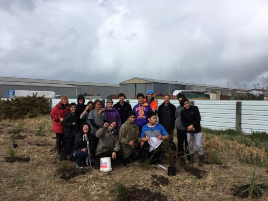
Advocate Tanea Tangaroa said the repo (wetland) has long been an important cultural landscape, food source and ecological environment for Whanganui.
“The repo was once a thriving wetland that provided food, materials and rongoa (medicines), nourishing the native birds and the community that traditionally lived here,” she said.
“But over the years, it has been hounded and pounded and cut off from the Whanganui River. Now it is polluted, there are gas pipes in there, asbestos, every chemical factory is right there.”
Tangaroa said the repo is a tupuna or ancestor, and she is calling on the community to come together to make a plan to bring it back to health, and to ultimately reconnect it to the Awa.
“Once you see the damage, you cannot unsee it. Our Kura Kaupapa is right there. We are all coming together to reclaim it – this is about getting some relationships moving.”
The wider community is welcome to a workshop to be held at Te Kura o Kokohuia, Matipo Street on Monday, 19 July from 6.00pm to 8.00pm. A number of workshops will also be held during the week.
Whanganui District Council senior stormwater engineer Kritzo Venter said the project is part of a programme of works in the council’s long-term plan.
“The development of a master plan for this area provides an opportunity to improve and enhance not only the ecology and water management issues, but also connectivity, cultural and community values,” he said.
“The area has been historically degraded because of former landfill activity but parts of the reconstructed wetland are in good condition, thanks to the work of Te Kura o Kokohuia, Tanea Tangaroa, Francis Ponga, the community and the council parks team.”
Any future enhancement also has the potential to mitigate flooding and stormwater issues in the Heads Road industrial area.
The area is one of the largest green spaces in the city. It includes some wetlands, informal pathways, and provides extensive views of the Whanganui River, Mt Ruapehu, Mt Taranaki and the surrounding landscape.
Kritzo Venter says the council is looking forward to working with the community and local hapū on the enhancement of the Kokohuia wetlands.
Register
Do you whakapapa to the Whanganui River? Would you and your whānau like to be registered on the Whanganui Iwi Database? What does that mean?
It means that you get sent pānui and updates on kaupapa related to the Whanganui River and Te Awa Tupua, the people and the river from the Mountains to the Sea. You can also apply for the different grants that are advertised on our website and facebook page.
If you are already on the database and need to up date your details please head to the database or send us an email at office@ngatangatatiaki.co.nz